Source: Earth Observatory
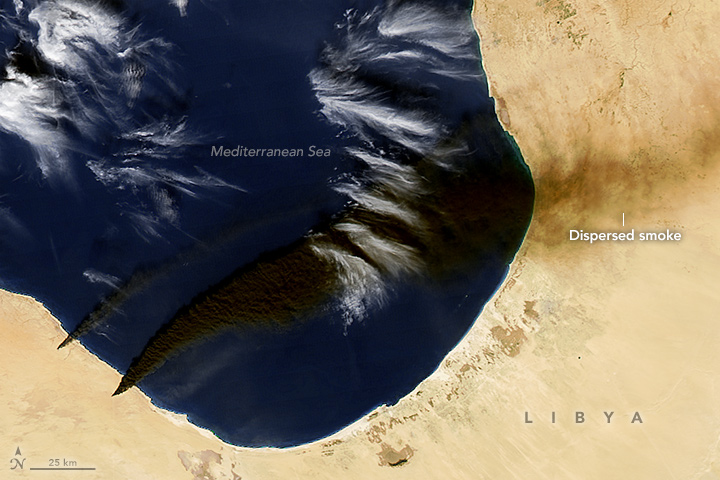
After battles in Libya on January 4–6, 2016, several fires were observed at oil production and storage facilities near Sidra, on the coast between Sirte and Benghazi. Smoke plumes from several oil tanks and facilities spread a pall of black smoke across the nation’s Mediterranean coast.
At 2:05 p.m. Libya time (12:05 Universal Time) on January 6, the Moderate Resolution Imaging Spectroradiometer (MODIS) on NASA’s Aqua satellite captured an image (top) of smoke plumes rising from the fires and blowing to the east and northeast. By 11:35 a.m. local time (09:35 Universal Time) on January 7, the winds had shifted, driving the smoke southeast as shown in an image acquired by the MODIS instrument on NASA’s Terra satellite.
A multispectal imager on the European Space…
View original post 236 more words
Filed under: Environment, News/ Current Events
